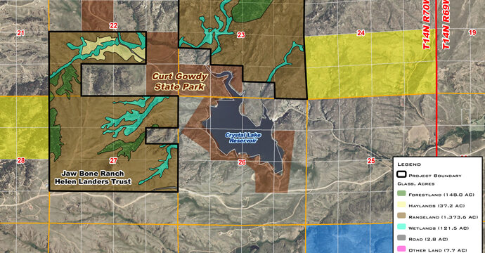
The Wyoming Land Trust (WLT), a private, non-profit organization working with land owners to conserve Wyoming’s agricultural and natural resources, began a partnership with WLC Engineering, Surveying and Planning to perform baseline GIS analysis services for Conservation Easement projects. These baseline analysis covered a broad spectrum of topics including wildlife habitat and distribution; vegetation communities and distribution; oil and gas infrastructure; transportation infrastructure; disturbance areas; encumbrances; GAP landcover; hydrography and wetlands; species of Greatest Conservation Need models; and cultural and historical sites. Through the analysis of these topics, WLC provided WLT staff with a series of exhibits and tables depicting the analytical findings. Board members utilized these exhibits and associated tables to determine if a given proposed conservation easement site met the organizations mission. Acceptance of a proposed site triggered additional analytical tasks associated with legal due diligence. WLC GIS staff worked very closely with the WLT to prepare and submit materials to project partners and funding sources in the most efficient manner possible. From 2009 until the end of 2012, WLC had prepared over two dozen baseline analysis packets for WLT projects spread across the state of Wyoming.