Providing excellent land surveying services means having top-of-the-line equipment on hand to do so. At WLC, we have a wide variety of land surveying tools that we select specifically for each, unique project. WLC measures angles accurately using the appropriate means whether visual, electronic, by laser, and more. From the sextants of ancient mariners to Satellite GPS used by astronauts, WLC provides cost effective measurement and surveying solutions. Here are our top five land surveying tools.
Standard Survey Tool
The standard and most important tool in the field after the surveyor themself is a shovel. Deeds and descriptions are like treasure maps left by people in the past. It is up to the surveyor to read and interpret those maps to put an “X” quite literally on the ground where the treasure or, in this case, a boundary corner lies hidden. The tools in this article help the Land Surveyor calculate a place to put that “X.” However, it is up to the common shovel to dig the treasure up and find the true location of the boundary corner.
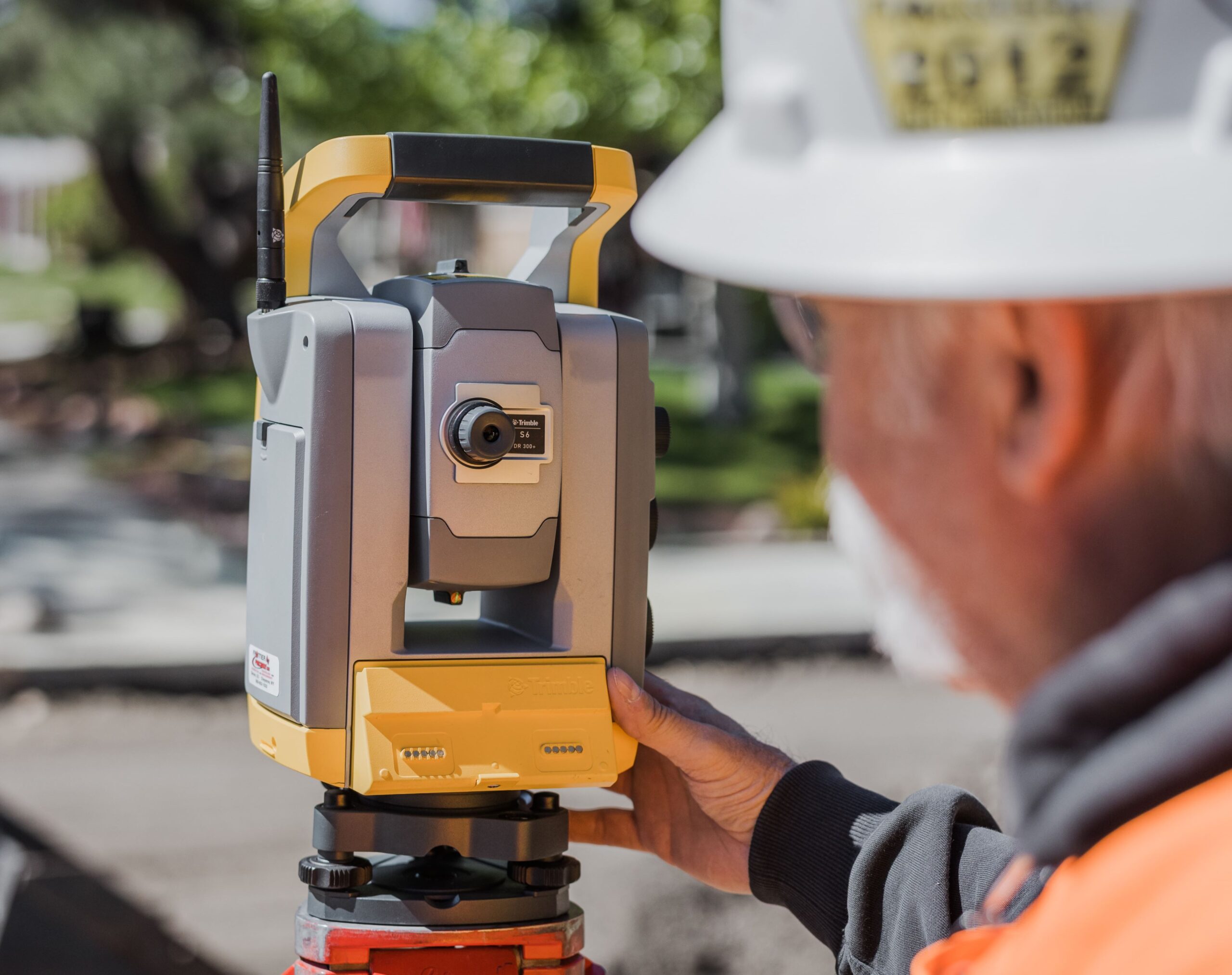
Robotic Total Station
Total stations are a staple piece of land surveying equipment. As an electronic, optical instrument, they are versatile, efficient, and extremely accurate. Since they operate remotely, only one surveyor is needed in the field. Through automation, a robotic total station electronically measures and records distances from specific points of reference. They also measure and log the coordinates of various points, angles, and distances. These instruments are commonly used to record locations of tunnel walls, ceilings, floors, and more for several types of projects including oil/mining, construction, electrical, and property boundaries.
Digital Level
An often-overlooked component of any project or height of an object is a digital level. A digital level is a high accuracy level made to electronically read a bar coded level rod. This system takes highly accurate elevation readings that are stored in the instrument. Next, the readings are downloaded as needed providing fast and accurate information to engineers and contractors. This information allows for informed and timely decisions to keep projects on tract and moving forward. Determining where something goes in space becomes critical when structures are designed to match a pre-existing structure. It can be embarrassing and expensive when a set of stairs misses a door or landing, or a heavy and costly I-Beam is just a “little too short.” The surveyors are often called upon to identify where a problem occurs vertically on a project; and digital levels assess these issues.
3D Laser Scanner
For a non-invasive solution to collecting data on a project, our teams turn to high definition scanners. With a high definition scanner, data can be acquired quickly and safely allowing our surveyors to avoid dangerous environments. A high definition scanner, or 3D laser scanner, uses narrow beam lasers to capture thousands of points per second with extreme accuracy. From here, these points are used to produce a digital, three-dimensional model of the project site or for other map and plan development.
Unmanned Aerial Vehicle (UAV)
An unmanned aerial vehicle (UAV), or drone, is used to capture aerial data, photogrammetry, topographic surveys, and more using downward-facing sensors with multispectral and RGB cameras. A UAV allows surveyors to collect data points efficiently and cost-effectively from above for mapping and producing digital imagery. This application is perfect for projects that cover a large area, include rough terrain, or prove difficult or timely to collect a large amount data by foot.
These tools are our top pieces of equipment, but there are many other tools and components used for land surveying. Measuring tapes, field books, tripods, and range poles are just a few examples of other critical pieces of equipment our surveyors have on hand. Learn more about our land surveying services and contact our team for your surveying needs. WLC is also currently seeking professionals to join our surveying team. Visit our careers page to learn about opportunities and to apply.