Surveying has been a core WLC service since the company’s inception over 70 years ago. With more than 275 years of combined experience, WLC surveyors have the expertise to execute any project on, under and even above the ground. As part of our cornerstone Land Surveying services, WLC began offering Aerial Surveying via Unmanned Aircraft Vehicles (UAVs) in 2017 and has since provided their aerial expertise on approximately 10 projects throughout Wyoming.
WLC’s uses small UAVs, commonly known as drones, to provide precise aerial surveying of just about any surface-area, especially those not conducive to conventional surveying methods, such as unlevel terrain and large surface areas. The images UAVs capture are processed to create a dense 3D point cloud, from which a textured mesh, and high resolution ortho-imagery are created.
The efficiency of collecting data with the UAV is especially helpful on projects that require timely execution, as a UAV is capable of collecting upwards of 300 images in 15 minutes. This kind of surveying efficiency allows crews to complete field work on multiple sites per day, ensuring timelines and budgets are met. In addition, for every minute of flying, the UAV covers approximately one acre and is capable of collecting 25 ½” resolution images. Compare that to conventional surveying methods where one acre in an urban environment can take a full day to map.
While aerial surveying may not be appropriate for every land surveying project, at WLC we’ve found UAVs are incredibly helpful on many pipeline, transmission, and transportation routing projects as well as projects that are difficult to access due to environmental or terrain constraints.
Notable Aerial Surveying Projects to Date
Rotary Park Pathway (Phase 2) Project in Casper in 2017 was the first project WLC used a drone on for preliminary survey and creation of existing contours in AutoCAD. This project was part of an ongoing project to connect a pathway from downtown Casper to Rotary Park, located at the base of Casper mountain. Because of the length and topography of the path, using a drone allowed WLC to more efficiently collect survey data.
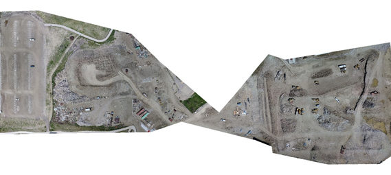
As part of civil engineering efforts on the Kelly Walsh High School construction project in 2017, WLC used a UAV to collect data for calculation of earthwork quantities on the nearly 20-acre site in Casper. The entire aerial survey was completed in one day, which included setting, surveying, and removal of aerial targets, collecting over 2,300 images and surveying surface check points with GPS.
For more information about WLC’s Aerial Survey capabilities, be sure to check our Projects page in the coming months or contact us today!